 GROUNDWATERStateWaterResourcesControlBoard地下水的水资源控制板

《GROUNDWATERStateWaterResourcesControlBoard地下水的水资源控制板》由会员分享,可在线阅读,更多相关《GROUNDWATERStateWaterResourcesControlBoard地下水的水资源控制板(60页珍藏版)》请在装配图网上搜索。
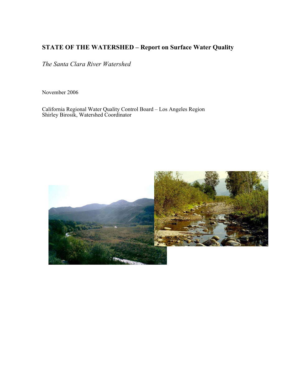
1、STATE OF THE WATERSHED Report on Surface Water QualityThe Santa Clara River WatershedNovember 2006California Regional Water Quality Control Board Los Angeles RegionShirley Birosik, Watershed CoordinatorPREFACEThis report is a descriptive document and no policy or regulation is either expressed or in
2、tended. It is one in a series written by the Regional Boards watershed coordinator which summarizes and characterizes surface water quality data for the Regions watersheds. These reports may serve many functions but they are primarily written to educate the public on the kinds of water quality data
3、available and what the data are generally saying. The Regional Board is often asked very basic questions about water quality in the Region and in many instances State of Watershed reports answer these questions. Some previous State of Watershed reports have been cited by other agencies in their envi
4、ronmental impact reports for various projects or have been used to justify pursuing grant funding to address problems noted. Another major purpose of the reports is to show how effectively or ineffectively we are all collectively doing monitoring and sharing data by going through the process of acqu
5、iring and merging data (including much historic data) from different sources and making these data accessible. Some of the people accessing them in the future may be Total Maximum Daily Load (TMDL) staff at the Regional Board but these reports are not pre-determining their conclusions, just reducing
6、 time spent on data/information assemblage and organization.Reference to groundwater quality is made due to the close linkage in this watershed between surface water and groundwater quality. However, this report is not meant to be a thorough evaluation of groundwater quality or the interactions betw
7、een surface and ground water. Much work by other Regional Board staff on the latter topic will be forthcoming in the near future. There is some discussion of the watersheds natural resources due to their extensive nature and since there are many wildlife-related beneficial uses sensitive to water qu
8、ality problems; however, this report is not meant to be a complete documentation of these resources.While a number of stakeholders in the watershed are currently involved in litigation on water issues, this topic has not been addressed in the report which is focused on a description of the watershed
9、, descriptions of discharges and diversions of water, and an evaluation of surface water quality data. The report does contain an evaluation of data by stream Reach; however, this is not an official Water Quality Assessment, merely a point of discussion. It should be noted that the Reach designation
10、s described here are as they appear in the Regional Boards Basin Plan; some Reaches may be described differently in the current 303(d) list. Hydrologic areas/subareas, and groundwater basins/subbasins are based on California Department of Water Resources descriptions as are the groundwater subbasin
11、acreages.An announcement of the draft reports availability for review and comment was made to the E-mail list previously assembled by UC Cooperative Extension for the Santa Clara Watershed U. Comments were received from the City of Santa Clarita, Castaic Lake Water Agency, County Sanitation District
12、s of Los Angeles County, Friends of the Santa Clara River, United Water Conservation District, and Ventura County Watershed Protection District. Prior to release of the public draft, in-house comments were provided by Regional Board staff.November 2006Shirley Birosik sbirosikwaterboards.ca.govWaters
13、hed CoordinatorCalifornia Regional Water Quality Control Board, Los Angeles RegionTABLE OF CONTENTSEXECUTIVE SUMMARYiiiSTATE OF THE WATERSHED1Physical Description of Watershed1Groundwater/Surface Water Interactions9Water Agencies and Water Use10Major Historical Events in Watershed13Biological Settin
14、g13The Watersheds Designated Beneficial Uses17Stakeholder Groups21Land Use Characteristics23Discharges into the Watershed24Water Quality Impairments35Surface Water Quality Data Summaries from Previous Reports36Discussion of Combined Surface Water Quality Dataset41Recommendations for Future Water Qua
15、lity Monitoring51Regional Board Activities Addressing Water Quality Issues52References54EXECUTIVE SUMMARY The Santa Clara River is the largest in southern California (about 1,600 sq. mi.) that remains in a relatively natural state; this is a high quality natural resource for much of its length. The
16、approximately 100miles long river originates in the northern slope of the San Gabriel Mountains in Los Angeles (LA) County, traverses Ventura County, and flows into the Pacific Ocean halfway between the cities of San Buenaventura and Oxnard (CRWQCB, 2004).Beneficial Uses in watershed:EstuaryAbove Es
17、tuaryContact & noncontact water recreationContact & noncontact water recreationWildlife habitatWildlife habitatPreservation of rare & endangered speciesPreservation of rare & endangered speciesMigratory habitatMigratory habitatWetlands habitatWetlands habitatSpawning habitatMunicipal supplyEstuarine
18、 habitatIndustrial service supplyMarine habitatIndustrial process supplyNavigationAgricultural supplyCommercial & sportfishingGroundwater rechargeFreshwater replenishmentWarmwater habitatColdwater habitatExtensive patches of high quality riparian habitat are present along the length of the river and
19、 its tributaries. The endangered fish, the unarmored stickleback, is resident in the river. One of the largest of the Santa Clara Rivers tributaries, Sespe Creek, is designated a wild trout stream by the state of California and supports significant spawning and rearing habitat. The Sespe Creek is al
20、so designated a wild and scenic river. Piru and Santa Paula Creeks, which are tributaries to the Santa Clara River, also support good habitats for steelhead. In addition, the river serves as an important wildlife corridor. A lagoon exists at the mouth of the river and supports a large variety of wil
21、dlife (CRWQCB, 2004).There are four major National Pollutant Discharge Elimination System (NPDES) dischargers (all Publicly-Owned Treatment Works POTWs), 11 minor dischargers, and 15 enrolled under general NPDES permits (non-stormwater). One hundred and fourteen facilities are currently enrolled und
22、er the general industrial stormwater NPDES permit. There are approximately 300 construction sites enrolled under the construction stormwater permit (the number of enrollees varies from year to year). And, there are eight facilities with Chapter 15 requirements while there are 54 facilities with non-
23、Chapter 15 waste discharge requirements. Included in the latter facilities are POTWs which discharge to percolation or evaporation ponds (CRWQCB, 2004). Various reaches of the watershed are currently 303(d)-listed (2002 list) as impaired for nutrients (and related effects), bacteria, salts (chloride
24、, total dissolved solids TDS), and sulfate), trash (in lakes), and legacy pesticides (CRWQCB, 2004). STATE OF THE WATERSHEDPhysical Description of WatershedThe Santa Clara River is the largest river system in southern California remaining in a relatively natural state. Its headwaters begin at Pacifi
25、co Mountain in the San Gabriel Mountains near Acton and it flows in a westerly direction toward the Oxnard Plain before discharging to the Pacific Ocean near the Ventura Marina. The watershed area is 1,634 square miles. Major tributaries include Castaic and San Francisquito Creeks in Los Angeles Cou
26、nty and Sespe, Piru, and Santa Paula Creeks in Ventura County. About 40% of the watershed is located in Los Angeles County and 60% is in Ventura County. Much of the watershed is in mountainous terrain within either the Angeles or Los Padres National Forests (AMEC, 2005) (Figure 1). The river exhibit
27、s some perennial flow in its eastern-most stretches within the Angeles National Forest, then flows intermittently westward within Los Angeles County. The principal tributaries of the upper river are Castaic Creek, Bouquet Canyon Creek, San Francisquito Creek, and the South Fork of the Santa Clara Ri
28、ver. Placerita Creek is a large tributary draining the westernmost end of the San Gabriel Mountains; it joins the South Fork which flows directly into the Santa Clara River (CDWR, 1993). Castaic Creek is a south-trending creek originating near Liebre Mountain that confluences with the Santa Clara Ri
29、ver downstream of the City of Santa Clarita. The Castaic Lake Reservoir is located on Castaic Creek (CPUC website). San Francisquito Canyon Creek is an intermittent stream in the watershed adjacent to Bouquet Canyon to the southeast (CDWR, 1993). Three small lakes are located in a normally enclosed
30、valley in the northeastern portion of the watershed. Lake Elizabeth and Lake Hughes are maintained by seasonal runoff and may also be fed by subsurface flows trapped by the San Andreas Fault. Lake Elizabeth overflows occasionally through a meandering channel into Munz Lake and thence into Lake Hughe
31、s. Munz Lake, an artificial lake, is maintained by ground water pumped into it from a nearby well. A bedrock sill prevents surface outflow from Lake Hughes to Elizabeth Lake Canyon (and thence into Castaic Lake), except during heavy storms (CDWR, 1993). Prior to the 1960s, the upper Santa Clara Rive
32、r (east of the County line) was largely rural/agricultural. By 1993, agricultural lands represented less than 7 percent of the developed lands. The city of Santa Clarita is the only incorporated city in the upper watershed (incorporated in 1987). Approximately 75% of the land in the upper Santa Clar
33、a River is within the Angeles National Forest (CDWR, 1993). The braided streambed and floodplain of the Santa Clara River mainstem consists of sandy and gravelly material and is highly permeable over much of its length which results in large quantities of surface water infiltrating into the ground w
34、ater (CDWR, 1993). Because they are perennial, effluent discharges to the river may have a greater potential effect on ground water quality, particularly during dry seasons and dry years, whereas flood flows may pass quickly through the basin. Conversely, the ground waters generally contain higher c
35、oncentrations of dissolved solids than surface waters at the same locality so greater discharge of ground water to the stream can greatly affect the quality of surface waters, particularly during low flows (CDWR, 1993). The Saugus WRP discharges to the river below Bouquet Canyon (Reach 6) and has a
36、dry weather design capacity of 6.5 millions of gallons per day (MGD). The Valencia WRP discharges to the river further downstream (Reach 5), about 1/3 mile downstream from the Old Highway Bridge and the Interstate-5 freeway near Rye Canyon Boulevard and has a dry weather capacity of 12.6 MGD (CRWQCB
37、, 2004). Some of the treated effluent from the facilities is recycled for use in landscape irrigation. Ground water begins rising just upstream of the discharge, therefore, most of the effluent remains as surface flow and can be a large component of surface flow at the county line. Other sources of
38、perennial flows besides rising groundwater and WRP effluent include tributary flows from Castaic Creek as well as agricultural return flows (CDWR, 1993). The mainstem river continues to flow above-ground from the upper Santa Clara River until upstream of the confluence with Piru Creek where it gener
39、ally becomes dry due to highly permeable soils. Perennial flow generally returns downstream of the confluence with Hopper Canyon Creek and continues through Piru, Sespe, and Santa Paula Creeks, and into the Oxnard Plain (Bachman, 2006). There are a total of eleven reaches defined in the Basin Plan b
40、y the Regional Board for the river and its tributaries (Figure 2) which very generally correspond to hydrologic areas (HAs) and subareas (HSAs) referenced frequently in documents produced by the Department of Water Resources (CRWQCB, 1994) (Figure 3). Other wastewater treatment facilities in the low
41、er reaches of the river which discharge to surface waters or to the ground include (CRWQCB, 2004): The Piru Wastewater Treatment Plant which serves the community of Piru. It has a design capacity of 260,000 gallons per day (gpd) and discharges secondary-treated effluent to two percolation ponds loca
42、ted about 500 feet from the Santa Clara River (Reach 4). The Fillmore Wastewater Treatment Plant which discharges secondary-treated wastewater (1.33 MGD design flow) to percolation/evaporation ponds and/or to a subsurface percolation field or to the Santa Clara River in Reach 3 if the groundwater ta
43、ble is high. The surface water discharge accounts for approximately 30% of the total effluent discharged annually. The Santa Paula Wastewater Reclamation Facility which discharges secondary-treated wastewater (2.55 MGD design capacity) to the Peck Road storm drain which flows into a natural, unlined
44、 channel and thence to the Santa Clara River in Reach 3. The Saticoy Sanitary District Treatment Facility which discharges a design capacity of 300,000 gpd treated municipal wastewater to evaporation/percolation ponds located on the north bank of the Santa Clara River (Reach 2). The Ventura Water Re
45、clamation Facility which discharges tertiary-treated wastewater (14 MGD design capacity) from domestic, commercial, and industrial sources into the Santa Clara River Estuary.Piru CreekPiru Creek is a major tributary of the Santa Clara River that flows intermittently through portions of the Angeles a
46、nd Los Padres National Forests. Piru Creek has its headwaters at approximately 5,200 feet above mean sea level (MSL) in Lockwood Valley located approximately 25 miles northeast of the City of Ventura. The subwatershed is characterized by both highly erodible and highly resistant rocks resulting in b
47、road alluvial subbasins alternating with gorges incised in bedrock. The Piru Creek subwatershed encompasses approximately 318,000 acres (SCWRP website). Several drainages in the upper subwatershed supply Piru Creek with year-round flows including Lockwood, Alamo, Seymour, Amargosa, and San Guillermo
48、 Creeks. The surrounding mountains contain metamorphic and granitic rocks. Historically, colemanite was mined in the headwater system and gold mines were established just south of Piru Creek. The creek meanders eastward approximately 30 miles while dropping 2,200 feet in elevation through a series o
49、f open valleys and steep gorges before reaching the Pyramid Lake Reservoir. Below the Pyramid Dam, the major tributaries within the lower subwatershed include Agua Blanca and Fish Creek located approximately a mile upstream from Blue Point Campground and 3 miles below Frenchmans Flat just south of P
50、yramid Lake, respectively. Most flow becomes subsurface in the lower reaches of these creeks. The creek below Pyramid Dam has an average slope of approximately two percent and contains scattered riffle-pool formations until reaching Lake Piru, behind Santa Felicia Dam. The creek then continues downs
51、tream through Piru Canyon, eventually merging with the Santa Clara River (SCWRP website). Of the three major tributaries to the lower Santa Clara River, only Piru Creek has major structural controls on its flows (CDWR website). Sespe CreekSespe Creek is a major tributary of the Santa Clara River tha
52、t flows through the southern portion of the Los Padres National Forest. Sespe Creek contributes approximately 40 percent of the total natural runoff in the Santa Clara River basin, which typically occurs from January through April. Flow in the upper portions of Sespe Creek and its tributaries may be
53、 intermittent at times but generally the majority of the Creek flows year-round (CDWR, 1989). Approximately 75 percent of the Sespe Creek subwatershed is characterized by rugged slopes and canyon walls of southern Pine Mountains and the northern slopes of the Topatopa Mountains. Elevations range fro
54、m approximately 2,500 to 7,510 feet above MSL. The Sespe Creek subwatershed encompasses approximately 207,700 acres (SCWRP website). The Sespe Creek headwaters originate near the Ventura/Santa Barbara County boundary within the Transverse Range of southern California. Numerous small tributaries loca
55、ted within the Pine Mountains ridges supply Sespe Creek with year-round flows including Abadi, Adobe, Cherry, Ladybug, and Burro Creeks. The tributaries range from low-gradient, small channels with moderately dense riparian vegetation to steep, narrow, boulder-lined canyons with little or no riparia
56、n vegetation. The creek flows in an easterly direction through a narrow depression between the Pine Mountain and Santa Ynez Faults before flowing southward. Major tributaries include the Lion Canyon, Hot Springs Canyon, Timber, and West Fork (SCWRP website). Sespe Creek supports a variety of land us
57、es and vegetation types. Several campgrounds occur along the drainage that provide limited access and recreational opportunities. The lower portion of the drainage near the Santa Clara River valley contains urban (the City of Fillmore) and agricultural development (SCWRP website). The creek has seve
58、ral designations aimed at preserving its unique resources. The approximately 219,700-acre Sespe Wilderness Area encompasses 31.5 miles of Sespe Creek. Established in 1992, the Wilderness Area contains a 53,000-acre Sespe Condor Sanctuary. Approximately 10.5 miles of upper Sespe Creek have been desig
59、nated as Wild and Scenic. Furthermore, the stream is designated as a Wild Trout stream from the Lion Camp area in the upper subwatershed downstream to the Los Padres National Forest boundary near the City of Fillmore (SCWRP website). Santa Paula CreekSanta Paula Creek is another major tributary of t
60、he Santa Clara River Watershed. The Santa Paula Creek subwatershed occurs within the Transverse Ranges of southern California. The San Andreas Fault zone lies approximately 30 miles north of the creek. The perennial creek is fed by springs located on the southern slopes of the Topatopa Mountains wit
61、hin the Los Padres National Forest. From its headwaters located near Hines Peak at an elevation of approximately 6,704 feet above MSL, Santa Paula Creek flows in a southeasterly direction through extremely steep-walled canyons for the first 12 miles until it reaches the coastal plain near Sulphur Sp
62、rings just above Steckel Park. The creek flows through Steckel Park along a gentle gradient and is relatively undisturbed. A series of riffles and pools occur in this area created by numerous granite boulders and unique channel morphology. From there the creek is joined by Mud Creek before continuin
63、g downstream approximately 5.5 miles to its confluence with the Santa Clara River. The drainage transitions from a braided stream morphology to a channelized system within the last 1,800 feet. The Santa Paula Creek subwatershed encompasses approximately 75,050 acres (SCWRP website).The climate of th
64、e Santa Paula Creek subwatershed is typical of the moderately elevated interior of southern California with mean seasonal precipitation ranging from approximately 36 inches in the Topatopa Mountains to 18 inches near the mouth of the creek. Over 90 percent of the precipitation occurs from November t
65、o April within this region (SCWRP website). Surface water diversions occur within the Santa Paula Creek streambed. The Santa Paula Water Works Diversion diverts surface water from the creek approximately 1,000 feet south of Steckel Park just below a United States Geological Survey (USGS) gauging station and just upstream of the confluence with Mud Cre
- 温馨提示:
1: 本站所有资源如无特殊说明,都需要本地电脑安装OFFICE2007和PDF阅读器。图纸软件为CAD,CAXA,PROE,UG,SolidWorks等.压缩文件请下载最新的WinRAR软件解压。
2: 本站的文档不包含任何第三方提供的附件图纸等,如果需要附件,请联系上传者。文件的所有权益归上传用户所有。
3.本站RAR压缩包中若带图纸,网页内容里面会有图纸预览,若没有图纸预览就没有图纸。
4. 未经权益所有人同意不得将文件中的内容挪作商业或盈利用途。
5. 装配图网仅提供信息存储空间,仅对用户上传内容的表现方式做保护处理,对用户上传分享的文档内容本身不做任何修改或编辑,并不能对任何下载内容负责。
6. 下载文件中如有侵权或不适当内容,请与我们联系,我们立即纠正。
7. 本站不保证下载资源的准确性、安全性和完整性, 同时也不承担用户因使用这些下载资源对自己和他人造成任何形式的伤害或损失。
