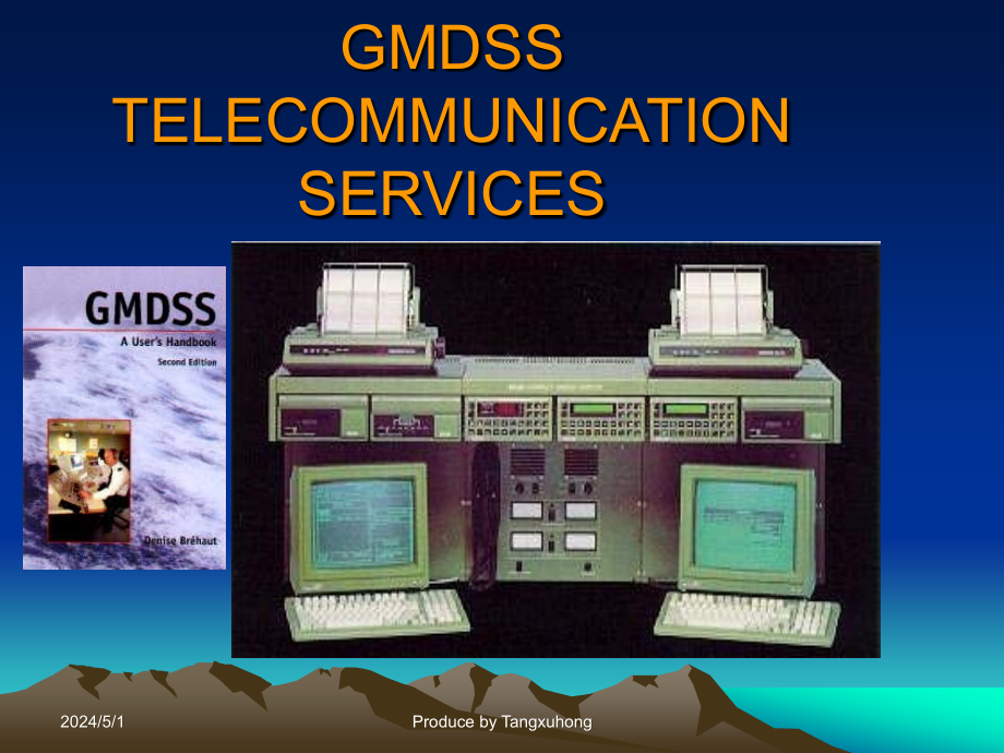
 海上无线电(GMDSS)通信业务TELECOMMUNICATION SERVICES

《海上无线电(GMDSS)通信业务TELECOMMUNICATION SERVICES》由会员分享,可在线阅读,更多相关《海上无线电(GMDSS)通信业务TELECOMMUNICATION SERVICES(76页珍藏版)》请在装配图网上搜索。
1、GMDSSTELECOMMUNICATIONSERVICES2024/5/12024/5/1ProducebyTangxuhongProducebyTangxuhongThislectureisaboutGMDSSservicesanditincludesmaterialscomingfrom:ITURadioRegulations(www.itu.int)ITU,headquarteredinGeneva,SwitzerlandisaninternationalorganizationwithintheUnitedNationsSystemwheregovernmentsandthepriv
2、atesectorcoordinateglobaltelecomnetworksandservices.Itincludesthreesectors:radiocommunicationsector,standardizationsectoranddevelopmentsector.TheITU-Rplaysavitalroleinthemanagementoftheradio-frequencyspectrumandsatelliteorbits,finitenaturalresourceswhichareincreasinglyindemandfromalargenumberofservi
3、cessuchasfixed,mobile,broadcasting,amateur,spaceresearch,meteorology,globalpositioningsystems,environmentalmonitoringand,lastbutnotleast,thosecommunicationservicesthatensuresafetyoflifeatseaandintheskies.2024/5/12024/5/1ProducebyTangxuhongProducebyTangxuhongSOLAS(International Convention for the Saf
4、ety of Life at Sea(SOLAS),1974)Chapter IV-RadiocommunicationsTheChapterincorporatestheGlobalMaritimeDistressandSafetySystem(GMDSS).Allpassengershipsandallcargoshipsof300grosstonnageandupwardsoninternationalvoyagesarerequiredtocarryequipmentdesignedtoimprovethechancesofrescuefollowinganaccident,inclu
5、dingsatelliteemergencypositionindicatingradiobeacons(EPIRBs)andsearchandrescuetransponders(SARTs)forthelocationoftheshiporsurvivalcraft.RegulationsinChapterIVcoverundertakingsbycontractinggovernmentstoprovideradiocommunciationservicesaswellasshiprequirementsforcarriageofradiocommunicationsequipment.
6、TheChapteriscloselylinkedtotheRadioRegulationsoftheInternationalTelecommunicationUnion.2024/5/12024/5/1ProducebyTangxuhongProducebyTangxuhongSTCW(International Convention on Standards of Training,Certification and Watchkeeping for Seafarers,1978)Shipstationmanagementrules2024/5/12024/5/1ProducebyTan
7、gxuhongProducebyTangxuhongTheassessmentsarenotfarawayfromnowanditTheassessmentsarenotfarawayfromnowanditwillbeheldinaroundwillbeheldinaround12th12thweekinthemiddleofthisweekinthemiddleofthissemester.semester.Therewillbetwoassessments.oneisinChineseTherewillbetwoassessments.oneisinChineseheldbyMariti
8、meAdministrationandanotherisinheldbyMaritimeAdministrationandanotherisinEnglishprovidedbyme.Englishprovidedbyme.Youhavetoworkhard.Youhavetoworkhard.2024/5/12024/5/1ProducebyTangxuhongProducebyTangxuhongChapter 1 Introduction to the GMDSS2024/5/12024/5/1ProducebyTangxuhongProducebyTangxuhongLearning
9、objectives to be achieved in this chapter:TohaveangeneralperspectiveofGMDSS.ToknowwhatarefourGMDSSseaareasA1,A2,A3,A4andcorrespondingshipequipmentcarriagerequirements.TounderstandwhatarenineGMDSSfunctions.2024/5/12024/5/1ProducebyTangxuhongProducebyTangxuhongGLOBAL MARITIME DISTRESS&SAFETY SYSTEMIn
10、1979,the International Maritime Organization decided In 1979,the International Maritime Organization decided to up-grade the existing communications system to to up-grade the existing communications system to incorporateincorporate new technologiesnew technologies available which would available whi
11、ch would significantly significantly improveimprove the safety of life at seathe safety of life at sea .The GMDSS Entered fully in Force(1st February 1999)(The GMDSS)2024/5/12024/5/1ProducebyTangxuhongProducebyTangxuhongVesselsaffected:AllpassengervesselsThe Global Maritime Distress&Safety System(GM
12、DSS)Cargo vessels of 300 grt and above on international voyages2024/5/12024/5/1ProducebyTangxuhongProducebyTangxuhongThe“old”Systemas per theas per theInternational Convention for the Safety of Life at SeaInternational Convention for the Safety of Life at Sea(SOLAS)1974(SOLAS)19742 major systems:Mor
13、setelegraphy(500Khz)oncargovesselsover 1600 GRT,all passenger vessels.Radiotelephony2182kHzandVHFCh16cargovesselsover300GRT,allpassengervessels.bothmanuallyoperated.minimumrangerequired100-150NM.2024/5/12024/5/1ProducebyTangxuhongProducebyTangxuhong2024/5/12024/5/1ProducebyTangxuhongProducebyTangxuh
14、ongNewMaritimeServicesEPIRB(COSPAS-SARSAT)INMARSATSYSTEM(A,B,C,F,M)NAVTEXDSCSARTS2024/5/12024/5/1ProducebyTangxuhongProducebyTangxuhong2024/5/12024/5/1ProducebyTangxuhongProducebyTangxuhong2024/5/12024/5/1ProducebyTangxuhongProducebyTangxuhongInmarsat-System Components2024/5/12024/5/1ProducebyTangxu
15、hongProducebyTangxuhong2024/5/12024/5/1ProducebyTangxuhongProducebyTangxuhongEquipmentvs.OperationalrequirementsThemajordifferencebetweentheGMDSSanditspredecessorsystemsisthattheradiocommunicationsequipment to be fitted to a GMDSS ship is determined by the ships area of operation,rather than by its
16、size.BecausethevariousradiosystemsusedintheGMDSShavedifferentlimitations,withregardstorangeandservicesprovided,GMDSSdividestheworldsoceansinto4areas(zones):2024/5/12024/5/1ProducebyTangxuhongProducebyTangxuhongGMDSSSeaAreasA1-CoastalareawithincoverageofatleastoneVHFcoastradiostationprovidingcontinuo
17、usavailabilityofDSCALERTING(20-30nm)A2-AreawithincoverageofatleastoneMFcoastradiostationprovidingcontinuousavailabilityofDSCALERTINGexcl.A1(150-200n.miles)2024/5/12024/5/1ProducebyTangxuhongProducebyTangxuhongA3-AreawithincoverageofInmarsatgeostationarysatellitesprovidingcontinuousavailabilityofaler
18、ting,excl.A1andA2,approximatelybetweenlatitudes70degreesnorthand70degrees south);A4-AreaoutsideseaareasA1,A2,andA3(veryhighlatitudes)2024/5/12024/5/1ProducebyTangxuhongProducebyTangxuhongGMDSS:ShipequipmentGMDSS:ShipequipmentcarriagerequirementscarriagerequirementsA1A2A3A4n VHF equipmentn s-EPIRB or
19、 VHF EPIRBn MSI receivernSARTn VHF and MF equipmentn S-EPIRB n MSI receivernSARTn VHF,MF and HF or satellite equipmentn S-EPIRB n MSI receivernSARTn VHF,MF and HF equipmentn 406 MHz S-EPIRBn MSI receivernSART2024/5/12024/5/1ProducebyTangxuhongProducebyTangxuhongn VHF DSC with radiotelephone n s-EPIR
20、B or VHF EPIRBn NAVTEXn 2 SART2024/5/12024/5/1ProducebyTangxuhongProducebyTangxuhong2024/5/12024/5/1ProducebyTangxuhongProducebyTangxuhong2024/5/12024/5/1ProducebyTangxuhongProducebyTangxuhong2024/5/12024/5/1ProducebyTangxuhongProducebyTangxuhongGMDSSSeaAreas2024/5/12024/5/1ProducebyTangxuhongProduc
21、ebyTangxuhongFunctionalrequirements(The9GMDSSCommunicationsFunctions)TheGMDSSregulations(chapterIVoftheInternationalSOLASConvention),requirethateveryGMDSSequippedshipshallbecapableof;-transmittingship-to-shoreDistressAlertsbyatleasttwo separate and independent means,eachusingadifferentradiocommunica
22、tionservice;-receivingshore-to-shipDistressAlerts;-transmittingandreceivingship-to-shipDistressAlerts;-transmittingandreceivingsearchandrescueco-coordinatingcommunications;2024/5/12024/5/1ProducebyTangxuhongProducebyTangxuhong-transmittingandreceivingon-scenecommunications;-transmittingandreceivingl
23、ocatingandhomingsignals;-receivingmaritimesafetyinformation;-transmittingandreceivinggeneralradiocommunicationsrelatingtothemanagementandoperationofthevessel;-transmittingandreceivingbridge-to-bridgecommunications.2024/5/12024/5/1ProducebyTangxuhongProducebyTangxuhongHow is the SAR system activated
24、by GMDSS?2024/5/12024/5/1ProducebyTangxuhongProducebyTangxuhong2024/5/12024/5/1ProducebyTangxuhongProducebyTangxuhong2024/5/12024/5/1ProducebyTangxuhongProducebyTangxuhong2024/5/12024/5/1ProducebyTangxuhongProducebyTangxuhong2024/5/12024/5/1ProducebyTangxuhongProducebyTangxuhong2024/5/12024/5/1Produ
25、cebyTangxuhongProducebyTangxuhongGMDSSSystemInclude:SatelliteCommunicationSystem-Inmarsat-COSPAS-SARSAT(EPIRB)TerrestrialCommunicationSystem-Radiotelephone-NarrowBandDirectPrintingTelex(NBDP)-SearchandRescueRadarTransponder(SART)-DigitalSelectiveCall(DSC)2024/5/12024/5/1ProducebyTangxuhongProducebyT
26、angxuhongInmarsat-System Components2024/5/12024/5/1ProducebyTangxuhongProducebyTangxuhongOperationalSpacecraftStatusPacific Ocean RegionInmarsat-3 F3178 Degrees EastIndian Ocean RegionInmarsat-4 F164 Degrees EastAtlantic Ocean Region WestInmarsat-3 F454 Degrees WestAtlantic OceanRegion EastInmarsat-
27、3 F215.5 Degrees West2024/5/12024/5/1ProducebyTangxuhongProducebyTangxuhongInmarsat Satellite Coverage2024/5/12024/5/1ProducebyTangxuhongProducebyTangxuhong2024/5/12024/5/1ProducebyTangxuhongProducebyTangxuhong Inmarsat-2 Inmarsat-3178E64.5E15.5W54WPacificOceanRegionIndianOceanAtlanticRegionOceanReg
28、ionWestAtlanticOceanRegionEastSpacecraft Status2024/5/12024/5/1ProducebyTangxuhongProducebyTangxuhongFunctionalrequirements(The9GMDSSCommunicationsFunctions)The9GMDSSCommunicationsFunctions)TheGMDSSregulations(chapterIVoftheInternationalSOLASConvention),requirethateveryGMDSSequippedshipshallbecapabl
29、eof;-transmittingship-to-shoreDistressAlertsbyatleasttwo separate and independent means,eachusingadifferentradiocommunicationservice;-receivingshore-to-shipDistressAlerts;-transmittingandreceivingship-to-shipDistressAlerts;-transmittingandreceivingsearchandrescueco-coordinatingcommunications;2024/5/
30、12024/5/1ProducebyTangxuhongProducebyTangxuhong-transmittingandreceivingon-scenecommunications;-transmittingandreceivinglocatingandhomingsignals;-receivingmaritimesafetyinformation;-transmittingandreceivinggeneralradiocommunicationsrelatingtothemanagementandoperationofthevessel;-transmittingandrecei
31、vingbridge-to-bridgecommunications.2024/5/12024/5/1ProducebyTangxuhongProducebyTangxuhongThe16The16NAVAREAs/METAREAsNAVAREAs/METAREAs2024/5/12024/5/1ProducebyTangxuhongProducebyTangxuhonglInmarsatanditsLESOstodaysupportawiderangeofdataproducts&servicesthatcaterforthemaritimeuser-morethanjusttalklDat
32、aisbecomingincreasinglyimportantintheefficientrunningoffleetmanagementoperationslFleetoperatorsmustchooseserviceprovidersofferingaclearandprovenmigrationpathfromlowtohighdatarateserviceslInternettechnologywillcometodominatemaritimemobiledatausageoverthenext5yearslInmarsatanditsLESOswillremainatthefo
33、refrontofInternetdevelopmenttosupportthemaritimeindustryInmarsat Ltd.2024/5/12024/5/1ProducebyTangxuhongProducebyTangxuhongSYSTEMCOMPONENTSlSpace SegmentmSatellitesmGround Support FacilitieslGatewaysmCoast Earth Stations(CES)mLand Earth Stations(LES)mGround Earth Stations(GES)lUser EquipmentmShip Ea
34、rth Stations(SES)mLand Mobile Earth Stations(LMES)mAircraft Earth Stations(AES)2024/5/12024/5/1ProducebyTangxuhongProducebyTangxuhongINMARSAT-SPOT BEAMSImproved spacecraft performance over localised area6dB enhancement over global beamPermits reuse of L-Band spectrumBenefits inter-system co-ordinati
35、on2024/5/12024/5/1ProducebyTangxuhongProducebyTangxuhongSpot Beam Coverage-AOR-E2024/5/12024/5/1ProducebyTangxuhongProducebyTangxuhongSpot Beam Coverage-AOR-W2024/5/12024/5/1ProducebyTangxuhongProducebyTangxuhongSpot Beam Coverage-IOR2024/5/12024/5/1ProducebyTangxuhongProducebyTangxuhongSpotBeamCove
36、rage-POR2024/5/12024/5/1ProducebyTangxuhongProducebyTangxuhongInmarsat Meeting Future Requirements InmarsatI-42024/5/12024/5/1ProducebyTangxuhongProducebyTangxuhongINMARSAT-43SatelliteconstellationPlannedintroduction2005ImprovedspacecraftperformanceGlobalBeam19MajorSpotBeamsConfigurablesmallerspotbe
37、amstypicallybetween150-175innumberPermitsextensivere-useofL-Bandspectrum2024/5/12024/5/1ProducebyTangxuhongProducebyTangxuhongInmarsat-2Inmarsat-3Inmarsat-4 No.of satellites44+1spare2+1spareCoverageGlobalbeam7widespots200narrowspots+19+globalbeamwidespots+globalbeamMobile link EIRP39dBW49dBW67dBWSat
38、ellite dry mass700kg1000kg2700kgSolar array span14.520.7m48mFlexibleHigher PowerInmarsat Satellite Evolution2024/5/12024/5/1ProducebyTangxuhongProducebyTangxuhongGMDSSFunctionsInmAInmBF77*InmCInmEDistressAlertingShip-to-shoreYesYesYesYesYesDistressAlertingShore-to-shipYesYesDistressAlertingShip-to-s
39、hipSearch&RescueCommunicationsYesYesYesYesOn-SceneCommunicationsYesYesYesYesTransmitting/ReceivingMSIYesLocatingsignalsYesGeneralCommunicationsYesYesYesYesBridge-to-bridgecommunications*Inmarsat Fleet F77 meets criteria onprioritisation/pre-emption contained in A.888(21)GMDSSCommunicationsFunctionsp
40、erformedbyInmarsatEquipment2024/5/12024/5/1ProducebyTangxuhongProducebyTangxuhongInmarsat A and Inmarsat B GMDSS FunctionsDistressAlertingShip-to-ShoreTelephoneandTelexSearchandRescueCommunicationsTelephoneandTelexOn-SceneCommunicationsTelephoneandTelexGeneralCommunicationsTelephoneandTelexInmarsat
41、A will cease operation 31st December 20072024/5/12024/5/1ProducebyTangxuhongProducebyTangxuhongStoreandForwardMessagingtelexdeliveryfacsimiledelivery(fromSESsideonly)PSTN/PSDNdeliverymobiledeliveryE-maildelivery(Internet,X.400)SpecialAccessCodes(SAC)deliveryEnhancedGroupCallsEGCSafetyNET(GMDSS)EGCFl
42、eetNETDistresscalling(GMDSS)DistressalertingDistressprioritymessagingDatareportingandpollingPositionreporting(dataandmessaging)Inmarsat C Services2024/5/12024/5/1ProducebyTangxuhongProducebyTangxuhongHighestPriority(Priority3)SizeoftheDistressAlert=1packetSimpleprocedureusingkeyboardenterinformation
43、inthedistressalertscreenshipsposition(maybeupdatedautomatically)shipscourse(maybeupdatedautomatically)shipsspeed(maybeupdatedautomatically)natureofdistress(sinking,abandonshipetc.enteredmanually)(IMN,date,timeisenteredautomatically)TransmitusingDistressButton(s),orUseRemoteDistressButton(s)Automatic
44、deliverytoMRCCwithminimumdelayInmarsat C Distress Alerting2024/5/12024/5/1ProducebyTangxuhongProducebyTangxuhongDistressPriorityMessagingTosendadditionalinformationtoMRCConthedistresseventandrequiredassistanceHighestPriority(Priority3)Sizeofthemessagelimitedto32kbytesAutomaticdeliverytoMRCCregardles
45、sofenteredaddressMinimumdelaySentusingkeyboardSometimeisrequiredtopreparedistressmessage2024/5/12024/5/1ProducebyTangxuhongProducebyTangxuhongFalseDistressAlertsAutomatedsystemsmakealertingeasyProblemingeneralthroughoutGMDSSReasonsforsendingfalsedistressalertscaninclude:Badinstallation-faultydedicat
46、eddistressbuttoninadequatetrainingusingPCforotherapplicationslackofresponsibility-RCCsconsidereachdistresscallasREALLackofoperationalprocedures-verysimpletosendalertlackofknowledgehowtocancelfalsedistressalerttechnicalproblemswithshipsequipmentmainreason-human error!CN114PreventionofDistressAlertsfr
47、omkeyboardonInmarsatC2024/5/12024/5/1ProducebyTangxuhongProducebyTangxuhongEGCSafetyNET(GMDSS)DistributionofMaritimeSafetyInformation(MSI)NavigationalwarningsMeteorologicalwarningsWeatherforecastsDistressalertrelay(shore-to-ship)SearchandRescuecoordinationOtherurgentinformationEGCFleetNET(Commercial
48、)DistributionofcommercialinformationE.g.Weatherrouting,companymessagesetc.EnhancedGroupCalling(EGC)services2024/5/12024/5/1ProducebyTangxuhongProducebyTangxuhongEnhancedGroupCalling(EGC)2024/5/12024/5/1ProducebyTangxuhongProducebyTangxuhongMaritimeSafetyInformation(MSI)NavigationalwarningsMeteorolog
49、icalwarningsWeatherforecastsDistressalertrelay(shore-to-ship)SearchandRescuecoordinationOtherurgentinformation2024/5/12024/5/1ProducebyTangxuhongProducebyTangxuhongMSIcanbeaddressedto.NAVAREA/METAREA(1-16)navigationalandmeteoinformationCircularareadistressalertrelaystormwarningsSARcoordinationRectan
50、gularareaurgentnavigationalwarningsCoastalareas(likeNavtex)coastalwarnings2024/5/12024/5/1ProducebyTangxuhongProducebyTangxuhongShore-to-ship distress alert to a circular area(45N35W999)Co-ordinates for circular area broadcast:D1D2=Latitude,La=Hemisphere,D3D4D5=LongitudeD6D7D8=radius in nautical mil
51、es2024/5/12024/5/1ProducebyTangxuhongProducebyTangxuhongUrgent MSI/Nav.Warnings to a rectangular area(40N070W20040)Co-ordinates for rectangular area broadcast:D1D2=Latitude SW corner,La=Hemisphere N or S,D3D4D5=Longitude SW corner,Lo=Longitude E or W,D6D7=extent of rectangle latitude in degrees,D8D9
52、D10=extent of rectangle longitude in degrees2024/5/12024/5/1ProducebyTangxuhongProducebyTangxuhong”CRITERIAFORTHEPROVISIONOFMOBILE-SATELLITECOMMUNICATIONSYSTEMSINTHEGLOBALMARITIMEDISTRESSANDSAFETYSYSTEM(GMDSS)”Inmarsat Fleet F77 is the only equipment to fully comply with the voice prioritisation and
53、 pre-emption requirements within:IMO Assembly Resolution A.888.21(November 1999)Fleet F77 and the GMDSS2024/5/12024/5/1ProducebyTangxuhongProducebyTangxuhong!FourLevelsofPrioritisationDistress,Urgency,SafetyandOther!Pre-emptionship-to-shore!Hierarchicalpre-emption-allcallswillbepre-emptedbycallsofah
54、igherpriority!Pre-emptionshore-to-ship!Hierarchicalpre-emptiononlybyanauthorisedentitysuchasan(M)RCC!ShiporiginatedcallswillalwaystakeprecedenceinanyprioritisationcategoryFleet F77 and the GMDSS2024/5/12024/5/1ProducebyTangxuhongProducebyTangxuhongVessel InitiatesShip-to-shoreCallIs callPriority lev
55、el 3(Distress)?Is callPriority level 2(Urgency)?Is callPriority level 1(Safety)?Is MESRegistered forcalls throughLES?RejectthecallCompletethecallYesNoYesYesYesNoNoNoFleet77Pre-emption/prioritisation2024/5/12024/5/1ProducebyTangxuhongProducebyTangxuhongInmarsat E2024/5/12024/5/1ProducebyTangxuhongPro
56、ducebyTangxuhongEMERGENCYPOSITIONINDICATINGRADIOBEACONInmarsat EInmarsat E will cease operation 1st December 20062024/5/12024/5/1ProducebyTangxuhongProducebyTangxuhongOperationviaGeostationarysatellitesIntegratedGPS(Positionwithin200m)DistressAlertDeliverytime5minutestypically1minuteInmarsat E2024/5
57、/12024/5/1ProducebyTangxuhongProducebyTangxuhongInmarsat E2024/5/12024/5/1ProducebyTangxuhongProducebyTangxuhongActivationMethodsAutomatic,Whenfloatingfree(Sea Water Activated)Manual,whileinitscradleRemoteControlfromBridgeInmarsat E2024/5/12024/5/1ProducebyTangxuhongProducebyTangxuhongTheInmarsatEEP
58、IRBincludes:L-BandOmni-directionalAntennaSearchandRescueRadarTransponderElectronicPositionFixingDevice(GPS)LowDutyCycleHighIntensityStrobeLightAudio/VisualindicationofactivationOptional121.5MHzHomingBeaconBatterypackInmarsat E2024/5/12024/5/1ProducebyTangxuhongProducebyTangxuhongFrameContentSystemCo
59、deEPIRBLongitudeEPIRBLatitudeCourseSpeedNatureofDistressTimeofLastPositionUpdateInmarsat E2024/5/12024/5/1ProducebyTangxuhongProducebyTangxuhongSystemTestsLivetesttransmissionsbyeachLESoverthesystemeveryhourtotestsystemintegrityTestresultssenttoInmarsatNOConlyNOTAssociatedRCCsInmarsat E2024/5/12024/5/1ProducebyTangxuhongProducebyTangxuhong
- 温馨提示:
1: 本站所有资源如无特殊说明,都需要本地电脑安装OFFICE2007和PDF阅读器。图纸软件为CAD,CAXA,PROE,UG,SolidWorks等.压缩文件请下载最新的WinRAR软件解压。
2: 本站的文档不包含任何第三方提供的附件图纸等,如果需要附件,请联系上传者。文件的所有权益归上传用户所有。
3.本站RAR压缩包中若带图纸,网页内容里面会有图纸预览,若没有图纸预览就没有图纸。
4. 未经权益所有人同意不得将文件中的内容挪作商业或盈利用途。
5. 装配图网仅提供信息存储空间,仅对用户上传内容的表现方式做保护处理,对用户上传分享的文档内容本身不做任何修改或编辑,并不能对任何下载内容负责。
6. 下载文件中如有侵权或不适当内容,请与我们联系,我们立即纠正。
7. 本站不保证下载资源的准确性、安全性和完整性, 同时也不承担用户因使用这些下载资源对自己和他人造成任何形式的伤害或损失。
